
A collection of signages I’ve recreated.
Locality Maps
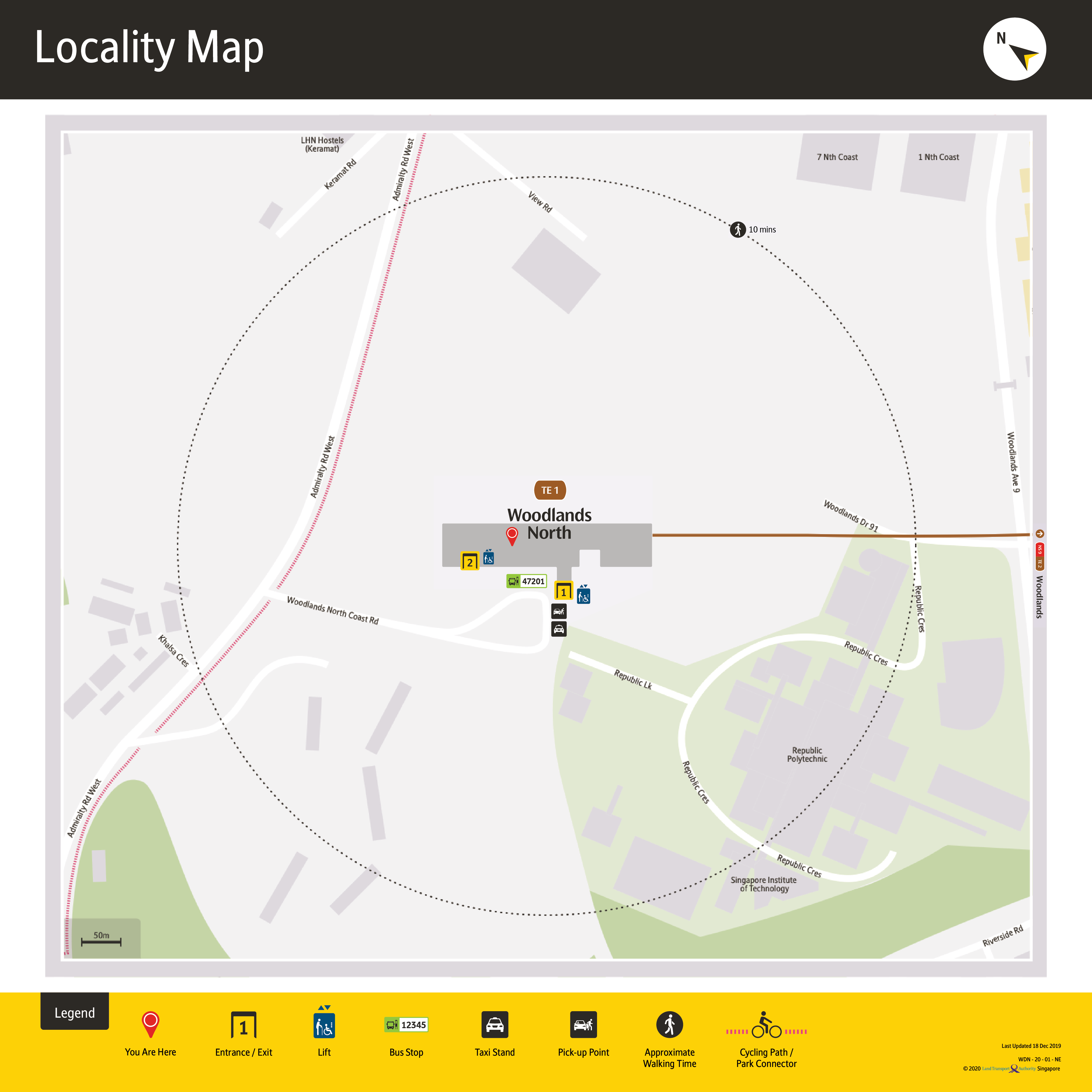
TEL – LM – WDN
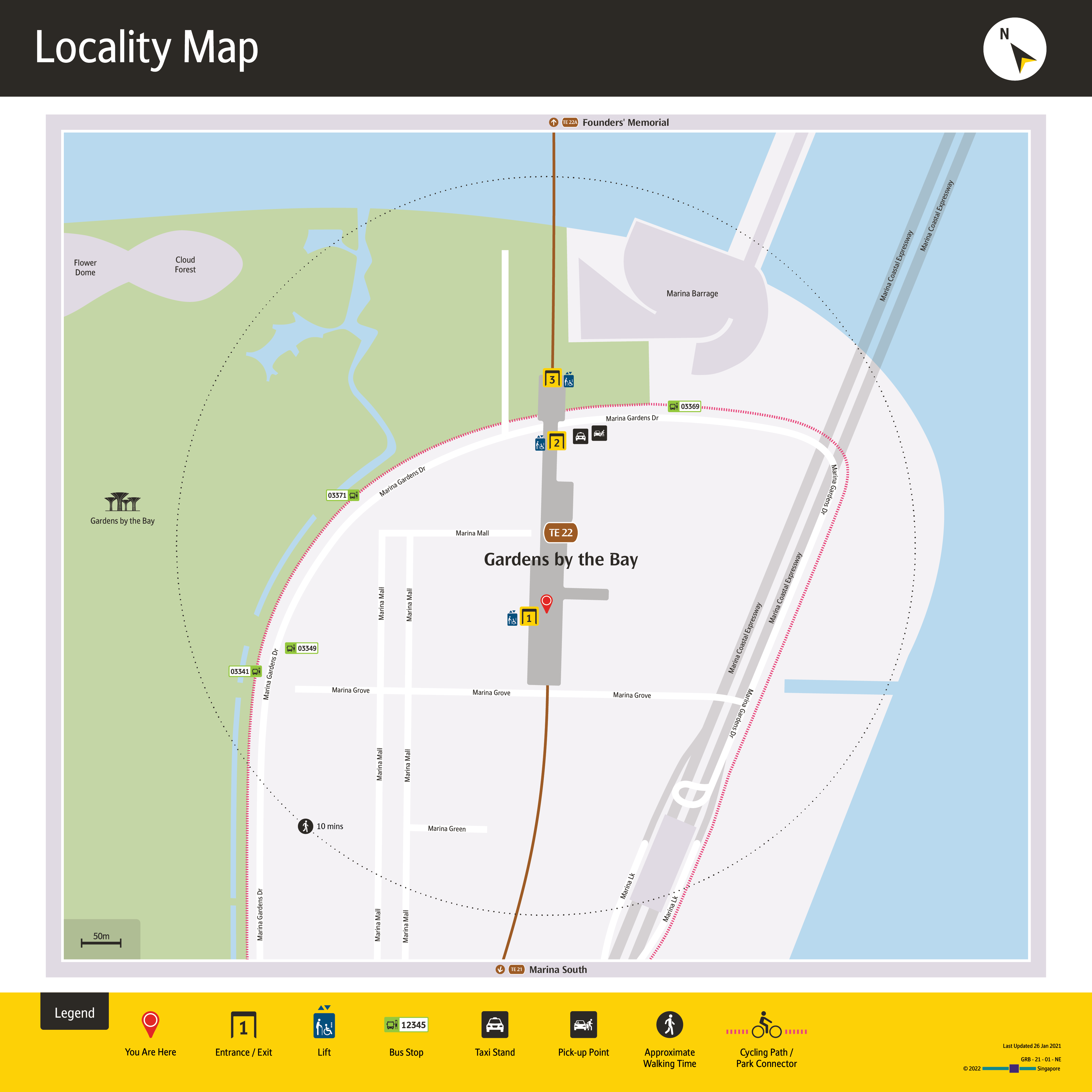
TEL – LM – GRB
PSD Signs
TEL – PSD – Station

TEL – PSD – Destination

TEL – PSD – Diagram – Stage 2
TEL – PSD – Diagram – Stage 3
TEL – PSD – Diagram – Stage 5

TEL – PSD – Diagram – CRL 2030
TEL – PSD – Diagram – Stage 5e
Line Diagrams
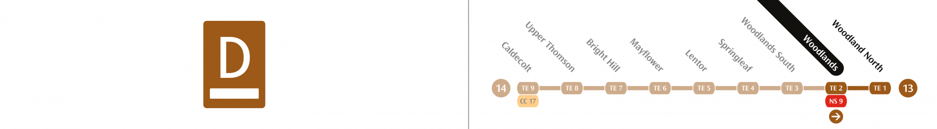
TEL – Line Diagram – Stage 5
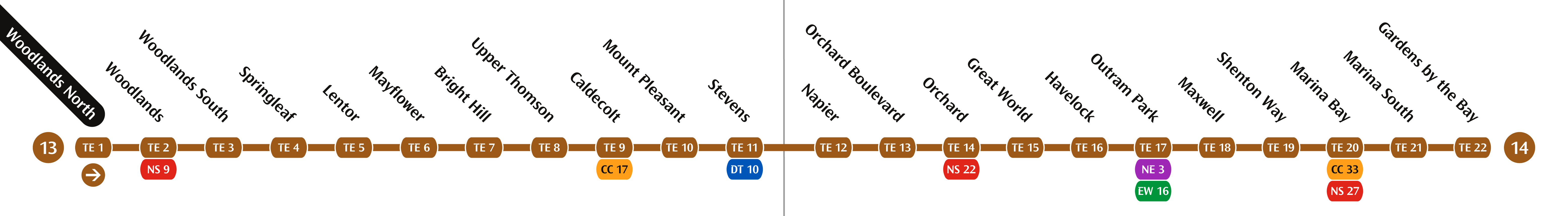
TEL – Line Diagram – Stage 2

Exit Directories
TEL – Exit Diagram – Woodlands North

TEL – Exit Diagram – Woodlands

First/Last Trains
TEL – First Last Train – TE6
Directions Signages
TEL – Directions

TEL – Directions – icons 2
TEL – Directions – icons 1
To anyone with access to the Transit Signage Manual from LTA, do email me a copy as I’m interested in the details on how the new signage systems works. I’ll keep it to myself if needed. *wink wink*
Leave a Reply to Wan Zhi Yoong Cancel reply